
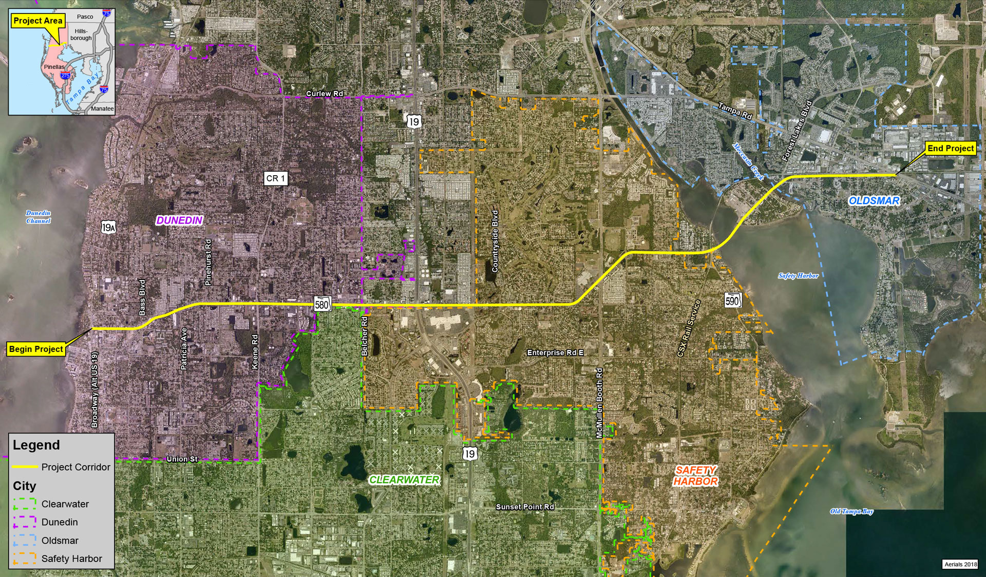
The Florida Department of Transportation (FDOT), District 7 conducted a corridor planning study along State Road 580 from Alternate US 19 to Tampa Road in Pinellas County – a distance of approximately 8.5 miles. Starting in the City of Dunedin SR 580 is a 4-lane divided urban arterial for almost a mile then transitions to a 4-lane undivided urban arterial to the cross street of Pinehurst Road where SR 580 adds a lane in each direction for a total of 6-lanes. The 6-lane SR 580 continues east until just west of SR 580/Philippe Parkway where it drops a lane in each direction to a 4-lane facility and continues to the end of the project at Tampa Road. Daily traffic volumes range from 10,800 vehicles per day to 48,500 vehicles per day along the corridor in the year 2018. The corridor has sidewalks on both sides of the roadway. Bike lanes are present on both sides of SR 580 from Alternate US 19 to Countryside Boulevard. The Corridor Planning Study was completed in June 2025.
Purpose
The purpose of this study was to identify multimodal improvements along the SR 580 corridor. SR 580 is a major east-west corridor in Pinellas County that traverses through and connects the cities of Dunedin, Clearwater, Safety Harbor and Oldsmar and provides access over Old Tampa Bay. The existing corridor is heavily developed and serves adjacent retail, commercial and residential land uses as well as local and tourist populations.
Need
Changing land use, population, and employment growth, increased multimodal users, safety and LOS concerns has led to the need of multimodal solutions to address mobility and safety needs to develop context sensitive improvements to help transform SR 580 into a multimodal urban corridor in keeping with the community context it traverses.