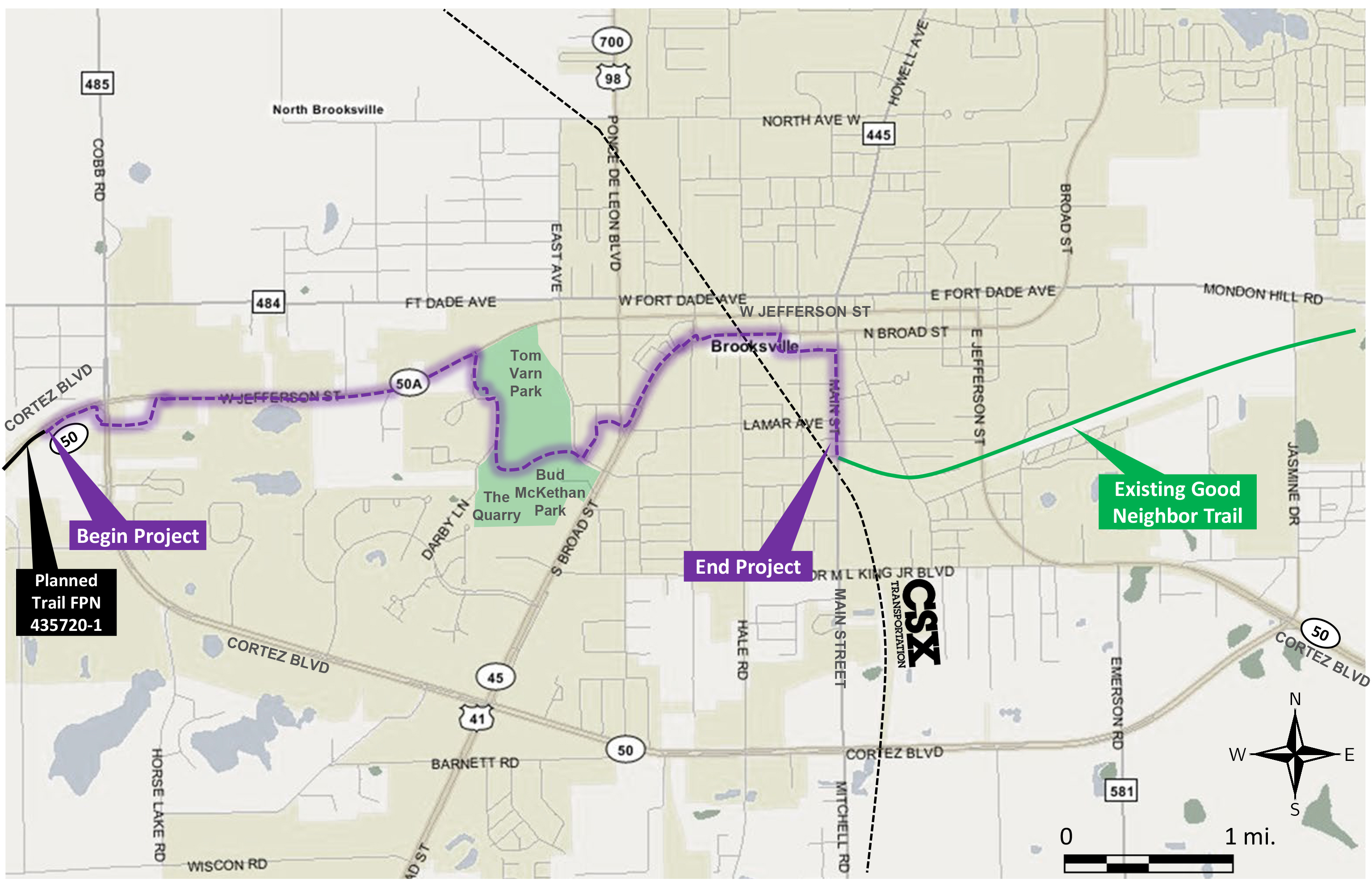
The Good Neighbor Trail Gap – The proposed Good Neighbor Trail through Brooksville will complete a gap in Florida’s Coast to Coast Trail in the Brooksville area. A project location map is shown in the map below. The proposed “gap trail” will begin on State Road (SR) 50/Cortez Boulevard, west of Cobb Road, and continue easterly through Brooksville, ending at the present beginning point for the Good Neighbor Trail near the intersection of Main Street and Russell Street. The total distance is approximately 3.2 miles. This project is a collaborative partnership among the City of Brooksville, the Hernando/Citrus Metropolitan Planning Organization (MPO), and the Florida Department of Transportation (FDOT). This proposed connector trail will tie into the planned Good Neighbor Trail on SR 50 to the west of this proposed trail.
An earlier corridor and alignment study was completed in 2016 for the Hernando Citrus Metropolitan Planning Organization (MPO). This previous MPO study served as the foundation for the current PD&E study.
Click image to view map larger

